Beskrivelse
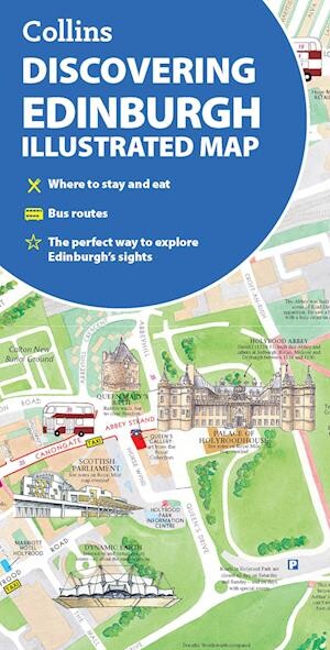
Explore Edinburgh with this beautifully illustrated map featuring charming watercolour paintings of the city's main sights and landmarks. It offers detailed coverage of popular areas, complete with essential travel info and a handy index.
An artistic and practical guide to navigating Edinburgh’s key locations and attractions.
This updated edition showcases individual watercolour illustrations of Edinburgh’s most famous landmarks, bringing the city’s charm to life on the map.
You'll find large-scale layouts of important spots like the Castle, Royal Mile, Botanic Gardens, Leith, and Newington, alongside street-by-street maps of Princes Street, George Street, Victoria Street, and the Grassmarket.
The map also highlights:
Covering the heart of Edinburgh, it stretches from Inverleith Park in the north down to The Meadows in the south, and from the Scottish National Gallery of Modern Art in the west to the Palace of Holyroodhouse in the east.
This map is an ideal companion for both visitors and locals wanting to discover Edinburgh in style and detail.
Yderligere information
| Kategori | Bøger |
|---|---|
| Genre(r) | Rejsebøger Storbritannien |
| Forlag | Collins |
| Udgivelsesdato | Er udgivet |
| Sprog | Engelsk |
| ISBN-13 | 9780008663476 |
| ISBN-10 | 0008663475 |
| Indbinding | Falset |
| Tags | Discovering Edinburgh Illustrated Map, Bøger, Bog |
| GPSR | Produktsikkerhed |