Beskrivelse
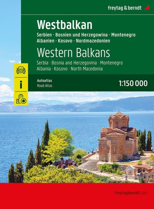
This road atlas covers the Western Balkans in detail, featuring Serbia, Bosnia and Herzegovina, Montenegro, Albania, Kosovo, and North Macedonia at a scale of 1:150,000. It also includes broader planning maps for the Balkans and Europe.
Comprehensive road and city maps with useful travel information across the Western Balkans.
This atlas provides detailed navigation with maps of the Western Balkans at 1:150,000 scale, including countries such as Serbia, Bosnia and Herzegovina, Montenegro, Albania, Kosovo, and North Macedonia.
Additionally, it offers planning maps of the Balkans at 1:1,000,000 and Europe at 1:3,500,000 scales, helping you get a wider perspective for your trip.
The atlas is spiral-bound with a concealed binding for easy handling. It highlights camping sites and pitches, along with tourist information to enhance your travel experience.
Inside, you'll find eight city maps covering major cities like Sarajevo, Tirana, and Belgrade.
A place register complete with postal codes is also included for quick reference.
The atlas contains 320 pages and measures 23 x 29.7 cm, making it a handy companion for exploring the Western Balkans.
Yderligere information
| Serie | Atlas |
|---|---|
| Kategori | Bøger |
| Genre(r) | Rejsebøger Diverse |
| Forlag | Freytag & Berndt |
| Udgivelsesdato | Er udgivet |
| Sprog | Engelsk |
| ISBN-13 | 9783707922899 |
| ISBN-10 | 3707922898 |
| Indbinding | Spiralryg |
| Sidetal | 320 |
| Genveje | Atlas - Bøger |
| Tags | Vestbalkan, Balkan, Freytag & Berndt, Bøger, Bog |
| GPSR | Produktsikkerhed |