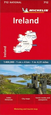
Discover Ireland with this detailed and easy-to-use road map from Collins. It covers the entire country, making it perfect for planning your routes and exploring new destinations.
A practical and durable map designed for smooth travel across Ireland.
This handy map combines the benefits of an atlas with the convenience of a fold-out design. It features vibrant, full-colour road maps at a scale of 10 miles to 1 inch, along with detailed city centre plans for Belfast and Dublin.
The map is laminated on both sides, ensuring it’s tough enough for repeated use and great value for travelers.
Key features include:
Clear, detailed mapping with attractive layered colours that indicate elevation.
Highlighted places of tourist interest and locations of Tourist Information Centres.
A distance chart on the back, showing measurements in both miles and kilometres.
Distances marked along the roads to help you plan your journey efficiently.
Vi er i fuld gang med at samle de nødvendige sikkerhedsoplysninger for alle vores produkter. Hvis du har spørgsmål til GPSR, er du velkommen til at skrive til os på Z3BzckBndWNjYS5kaw==.